
California Chukar Hunting: Planning a First Season on Alectoris chukar
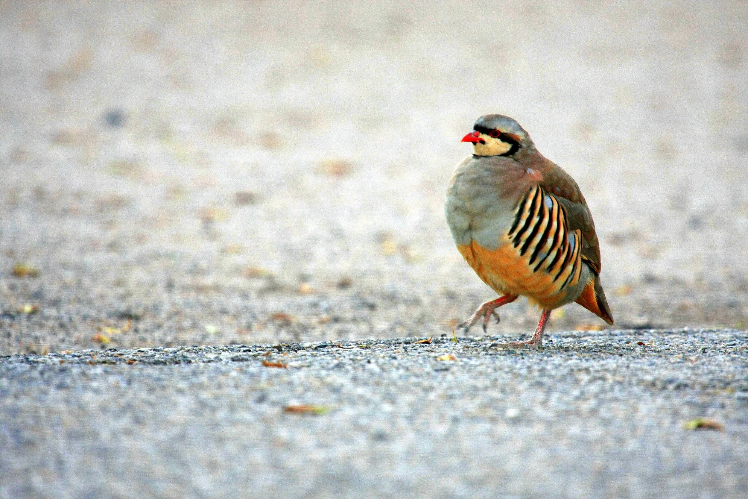
A chukar mid-stride on open ground in Tonopah, Nevada — red bill, black eye-line, and barred flanks in profile. Legacy stock, queued for replacement with original California photography by July 2027. Photo: Seabamirum on Flickr / CC BY 2.0 — source

A note before we begin. Peter grew up hunting chukar on the Nevada side of the Sierra, in basalt canyons that drain east instead of west. Adjacent country, same bird, same lungs-and-knees arithmetic, and the one part of this page written from the inside. Matt has never hunted California chukar, and Alan, Peter's three-year-old English cocker, is a flushing dog in a game most of the sources describe behind pointers. Everything past Peter's Nevada experience comes from CDFW forecasts, BLM hunt-area maps, a biologist conversation, four years of cross-referenced trip reports, and what this site has published on California chukar hunting in the Owens Valley, on the Modoc Plateau, and in water mapping.
We're writing it because of the pull rather than the plan. Chukar is the California bird people organize whole autumns around and then describe in the language of penance — the climb, the wind, the covey that got up two hundred yards out and went over the rim. The gap between what the country costs and what people keep paying is the thing worth explaining. So this page is for the hunter asking what we've been asking: how would you plan a first California chukar season from a standing start? We'll rebuild it every July, ahead of the next opener.
California Chukar: Know the Bird
Chukar partridge (Alectoris chukar) is a non-native, fully established upland game bird here. Introduced from central and southwest Asia by western state wildlife agencies from the 1930s on, California's populations have been self-sustaining without supplementation for more than half a century. The bird that flushes out of an Inyo County drainage at first light is a wild bird whose great-grandparents flew the same canyon.
It is a handsome animal: pale gray-brown back, buff belly, vertical black flank bars, a bold black mask through the eye and down to the throat, red bill, red legs. Both sexes look alike, so you don't sex one in flight. They run 19 to 27 ounces and hit the hand with surprising density.
Coveys form by August and hold through the season, typically 10 to 25 birds with larger congregations on better ground. Birds are vocal year-round; the chuk-chuk-chuk-chuKAR call is one of the great sounds of the high desert, and males call from elevated perches at dawn and dusk in spring and early summer. You can audit new country in July by parking on a ridge at sunrise and killing the engine.
Daily rhythm matters more for chukar than for almost any other California upland bird. At first light they drop off roost ledges and contour toward water — almost always the lowest reliable seep, spring, or guzzler in the drainage. They drink, feed the wetter margins for an hour, then walk uphill as the temperature climbs. By mid-morning they're loafing in shade — basalt overhangs, sage thickets, the north side of a boulder field — and may not move for four hours. Late afternoon they come down, drink again, and roost above the water. First light and last light are the only windows when chukar are predictably in motion at huntable elevation.
Three Regions, One Template
The Eastern Sierra and Owens Valley. Inyo and Mono counties — the long dry east-facing slope from the Sierra crest into the Owens Valley, the volcanic country between Bishop and Lone Pine, the canyons above the Owens River and along the west flank of the White-Inyo Range. BLM Bishop Field Office land dominates access. Steep, treeless (sagebrush, bitterbrush, mountain mahogany), and the country most people picture when they hear the word. Our Owens Valley planning piece goes deep on it.
The Modoc Plateau and Northeast California. Modoc, Lassen, and northern Siskiyou counties — basalt rim country, sage-steppe at 4,500 to 6,500 feet, scattered juniper, seasonal springs that vanish in late August. BLM Eagle Lake and Applegate field offices manage most access; the Modoc National Forest covers the higher ground. Gentler and broader than the Owens, with less vertical relief, but the bird-and-water relationship is identical. The Modoc Plateau planning piece is the companion read.
The southeast deserts and the Mojave fringe. San Bernardino, southern Inyo, and eastern Riverside counties hold chukar in the higher, wetter ranges — the Granite, Providence, New York, Clark, and Kingston mountains. Remote, water scarcer, populations thinner. Most California chukar hunters never get down here, which is part of why the country still holds birds.
The template underneath all three is the same. Chukar need three things in proximity: water, the limiting resource for most of the season; escape cover, steep and broken and often vertical — basalt rim, talus, cliff band, dense sage in a steep draw; and the elevation band where the forage grows, meaning cheatgrass seed heads, fiddleneck, filaree, bitterbrush, and the green shoots around a spring-fed seep. The band moves with the season, but in any given week it is narrow and predictable.
That water is also where the conservation story lives. The CDFW and BLM guzzler networks across the Eastern Sierra and Modoc Plateau are the difference between a stable population and a drought crash, and they need maintenance hours every spring. Cheatgrass is both the bird's primary forage across much of its range and one of the most fire-prone invasive grasses in the West; cheatgrass fire kills the sagebrush and bitterbrush chukar shelter in, and the recovery is usually more cheatgrass and less native shrub. Our fire layer on the upland map is the place to see where that has already happened. The chukar question and the sage-steppe question have become one question. The Eastern Sierra is also the southern end of the Bi-State sage-grouse population, a distinct population segment the U.S. Fish and Wildlife Service first proposed for threatened status in 2013, on ground chukar share — lek protection, habitat treatment, and predator work all land on chukar as a co-occupant.
The Year on the East Side
January–April. Coveys persist through post-season cold on the remaining water, then break up as males start calling from elevated perches and pairs form. Spring is the best stretch to audit new country by ear: drive, stop, listen, mark the call locations.
May–June. Nesting peak — hens nest under sage or rock overhangs and lay clutches of 10 to 21 eggs. Hot, dry weather in late May and early June is the single biggest variable on the year's covey count, because dry-down kills chicks.
June–August. Hatch, then broods moving to water; off-season scouting starts in earnest. Our water-mapping piece has the method for finding springs and guzzlers on a topo at 11 p.m. in July. By August broods consolidate into coveys and the work moves outdoors — drive at first light, glass slopes, mark coveys.
September. The last reliable scouting window: country dry, water concentrated, birds moving predictably.
October. The 2026-27 season opens statewide on Saturday, Oct. 17, under the CDFW upland regulations. Coveys at their largest, water still concentrated, birds naive. The best two weeks of the year.
November–January. Storms, dropping snow line, birds moving downslope. Hunting gets harder, ranges open up, and cold takes pace out of dogs and hunters both. The season closes Jan. 31.
Working the Country: The Nevada Anchor and the California Record
One of these five is Peter's, spoken in his own voice from seasons he actually hunted. The other four are what the sources describe, and we've marked them that way on purpose.
Water first. Peter hunted his Nevada canyons this way, and it is the most repeated line in the California sources too. Water is the limiting resource through September and October, and birds use the lowest reliable source in their drainage daily through the dry months. E-scouting the drainage at home — springs off the blue spring symbol on a USGS quad, perennial creeks, BLM and CDFW guzzlers — locates the high-probability coveys before you leave the truck. The full method is in Mapping Chukar Water in the Off-Season.
The band, not the slope, is what the accounts describe hunters walking. Chukar do not occupy slopes uniformly. The reports put them in a narrow band, typically 200 to 500 vertical feet wide, between the daytime loafing cover above and the morning-and-evening water below — where the cheatgrass and forb forage is and where escape cover is reachable in a thirty-foot uphill scramble. Walking that band on contour, parallel to the slope rather than up and down it, is described as covering ground efficiently and staying where the birds are.
Climbing above the birds before first light is the most consistent pattern in the reports. Chukar flush uphill when pressured, almost without exception, so a hunter coming from below is described as pushing birds out the top of the country into the next canyon, while a hunter coming from above pushes them down the band, where they reportedly hold tighter and any flush is a downhill going-away shot at huntable range. The climbing is brutal in every telling; so are the shots.
Glass-then-walk is the order every source puts it in. Optics come up more often for chukar than for any other California upland bird: a 10-power binocular or a 50-to-60mm spotting scope, from a glassing point at first light, is credited with locating coveys before a hunter commits to a half-mile climb. Our piece on glassing optics for chukar country covers which glass earns its weight.
Chukar punish enthusiasm. The country is steep enough and the air thin enough that the second mile costs twice the first, and a covey bumped too far ahead at 8 a.m. is a covey nobody relocates at 3 p.m. Pace is the variable the accounts keep coming back to.
Say plainly what this page cannot do: it will not tell you which drainage is holding birds this October. Secondhand tactics narrow a mountain range to a canyon, and only boots and a bad morning narrow a canyon to a slope.
Dogs and the Gear the Ground Demands
Chukar are a pointing-dog bird nearly everywhere they live, and the conversation tilts toward the bigger-running breeds — English pointers, GSPs, Brittanys at the larger end, English setters. The country is too big and the birds too wary for a close-working dog to cover efficiently. That said, plenty of California chukar hunters run Labradors and other flushing dogs well: the dog works closer, the hunter covers less country at a slower pace, and the bird still gets up inside shotgun range.
The country is also brutal on dogs — rock, cheatgrass, October heat that can still hit 90°F at 4,500 feet, abrasive sage and bitterbrush. Pad conditioning starts in May, and water on the dog is not negotiable; Peter's What I Carry for Alan is the packing logic, scaled up here with more water capacity and a longer-range GPS collar.
On gear: a 20- or 12-gauge double or autoloader, modified or improved-modified, because shots run 25 to 40 yards with the occasional 45-yard downhill bird and patterns have to hold together. Bismuth 6 or 5 is the load the sources lean on; steel 5s or 4s are the cheaper option in the larger gauges, and whichever goes in the vest gets shot at paper first — our patterning piece has the method. For next season, order in July; the nonlead-ammo planning piece explains why. A strap vest with three-plus liters for you and a separate liter for the dog. Weather pants over brush pants: wind shell and light insulation for the predawn climb, sheddable by 9 a.m. Boots are where we'll be most opinionated — stiff midsole, eight to ten inches, real toe rand, Crispi or Kenetrek or Schnee's or Russell tier, because cheap boots break your feet on basalt scree by Wednesday. A 10x42 binocular minimum, and enough water that the truck is never the only refill: four to six liters per hunter is a normal chukar day.
Licenses, Limits, and Dates
These are the 2026-27 figures from CDFW's upland game bird regulations and license fee schedule. The booklet remains the authority.
Resident hunting license, $64.54, plus the Upland Game Bird Validation at $25.41, valid July 1, 2026, through June 30, 2027. Ten dollars of the validation is the Nesting Bird Habitat Incentive Program surcharge from AB 614, in place since the 2022-23 license year and projected by CDFW at more than $2 million a year; it pays landowners to keep nesting cover for ducks, wild pheasants, and other grassland birds. See our breakdown of where the money lands.
Daily bag: 6 chukar. Possession 18.
Shot: nonlead. AB 711 finished phasing in statewide on July 1, 2019, and upland got no carve-out.
HIP validation: not required — HIP covers dove, band-tailed pigeon, snipe, and waterfowl, not chukar. Hours:half an hour before sunrise to sunset.
Dates: Saturday, Oct. 17, 2026, through Sunday, Jan. 31, 2027 — one general season, statewide, with no zones.
Next Reads
The canonical link target for everything we publish on chukar, rebuilt each July.
The weekly digest — planning pieces and field reports each Sunday, plus the 2026-27 California Upland Cheatsheet — lives at the subscribe page.
Peter still talks about his Nevada canyons the way people talk about a place that beat them and got away with it. That's the part we can't research, and it's the part that gets us to the trailhead. Good hunting.
Matt Gehrmann grew up hunting the Central Valley for pheasant, quail, and dove, and is based in the Bay Area. Read more → · Subscribe to the weekly digest →
Peter Burnham grew up in Nevada hunting chukar in the Sierras and dove in the valleys and hunts behind Alan (a three-year-old English cocker). Read more → · Subscribe to the weekly digest →