Planning a First Trip to Owens Valley Chukar Country: What We Found, and What We'll Find Out in October
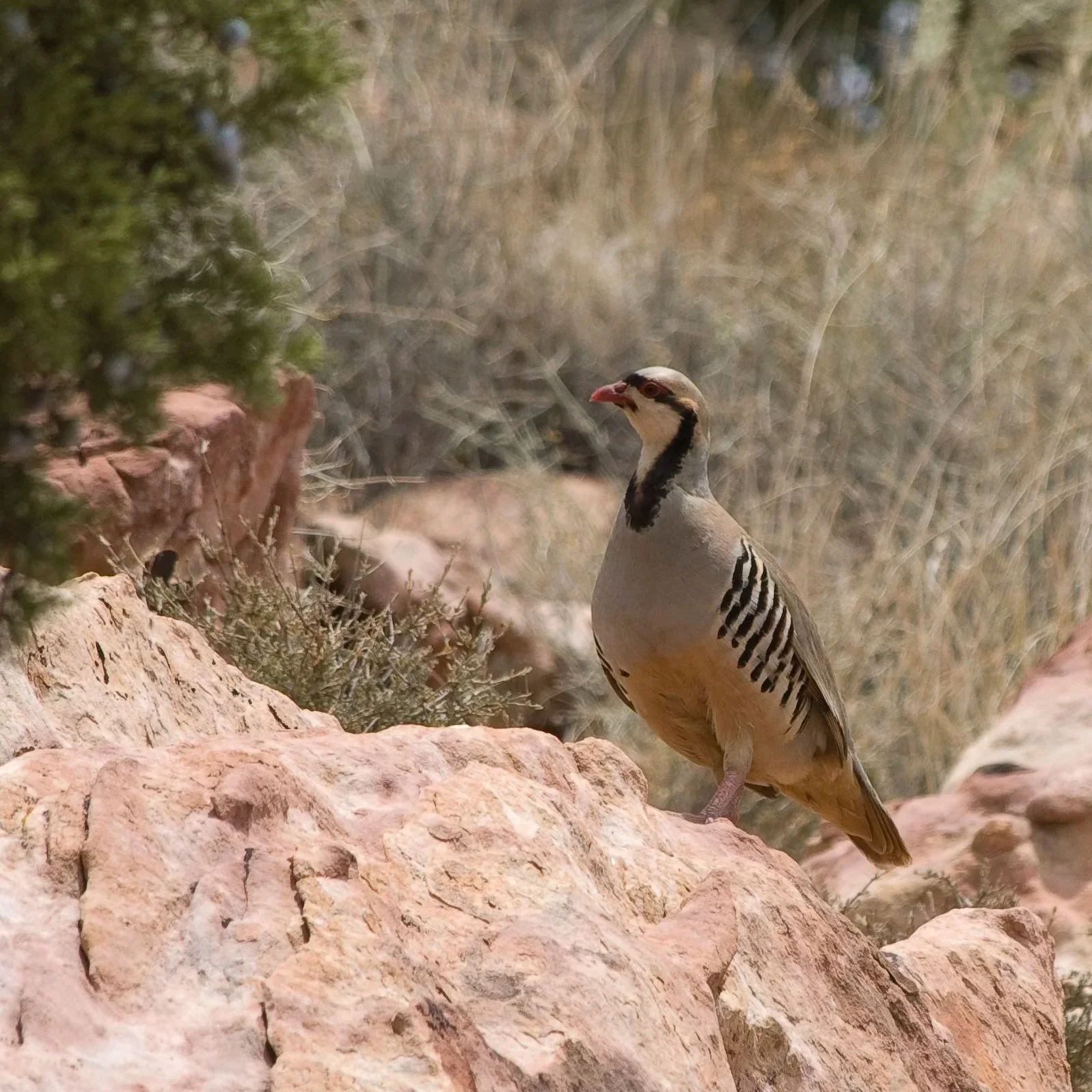
Photo: Chuck Abbe / CC BY 2.0 — source
.jpg)
We haven't been there yet.
What we have done is spend the better part of a winter evening going deep on the Owens Valley — topo maps pulled up on one screen, CDFW regulations on another, a half-dozen trip reports from forums we trust enough to read critically. What follows is what we found. Come fall, we'll file the hunt story. Consider this the research, not the report.
Why the Owens Valley
The pull is the terrain. Chukar (Alectoris chukar) are not native to California — they came over from the rocky, arid slopes of Central Asia and the Middle East, and when they were introduced to the American West in the mid-twentieth century, they apparently looked at the eastern Sierra Nevada and recognized something familiar. Steep basalt faces, sparse vegetation, reliable water sources low on the slope, escarpment in every direction. The Bureau of Land Management (BLM) administers millions of acres along the Sierra's eastern face, running south from Bishop through Big Pine and Independence down to Lone Pine — public land, no access fee, no gates. What the maps can't convey is the scale of it. Every trip report mentions the scale.
The birds that live here are not put-and-take. They're wild animals that have survived hawks and coyotes and the physics of living on a 45-degree rock face in Mojave heat. Every account we've read makes this point, usually as a warning.
Learning to Read the Elevation
The most consistent piece of advice across everything we've read: the daily vertical movement of chukar is the key variable, and if you don't understand it, you will spend a lot of miles walking below birds.
The pattern goes like this. Early morning, coveys move downslope toward water to drink. As the day heats, they push back up into rockier, more exposed terrain. By late afternoon they're working back toward water again before roosting mid-slope. The practical implication for a first-timer is uncomfortable: if you're starting from the truck and walking uphill from a valley-floor trailhead, you're already behind. The hunters who find birds consistently in this country start at or above the water source by first light and hunt laterally across the elevation band, not straight up through it.
Most productive ground sits between roughly 4,500 and 7,500 feet on south- and west-facing slopes. Water — a seep, a stock tank, a reliable spring within a half-mile — is apparently the most useful scouting variable in a landscape this dry. We've been marking springs on a downloaded topo for two months.
The Dog Question
We're bringing a 34-pound English field cocker named Alan. This is, by every account we've read, completely the wrong dog for the job.
Alan is built for pushing pheasants out of Central Valley tules and hunting tight to the gun in dense cover. He’s been great on wild quail during tough Northern California all day hunts. That said, the chukar literature is unanimous that you want a medium-ranging pointing breed you can see and communicate with when you're both gasping at 7,000 feet on a basalt face. Alan will be invisible behind the first rock he passes, and he does not point.
What Alan has going for him is that he is relentless, he handles heat better than most flushing dogs we've seen, and he has never once in three seasons declined to go into cover that looked miserable. Whether any of that translates to steep talus and wild birds that flush uphill into the next canyon, we genuinely don't know. We'll find out.
The conditioning piece feels especially important given the mismatch. August hill work starts now. A dog unprepared for four to six hours of altitude and rock will be lame by day two — and a small dog unprepared for it will probably be carried out.
We're also packing more water than we think we need and a full dog first aid kit. That last item came up enough in the trip reports that it's already staged by the door.
Regulations
Chukar season runs concurrently with the general quail season — typically mid-October through late January. The daily bag limit is six chukar with an 18-bird possession limit, counted separately from the quail bag. Most of the productive eastern Sierra terrain is BLM public land with no special permit required.
The non-lead requirement applies to all California upland hunting, including chukar. The hunters we've read have largely settled on bismuth or high-density steel for 12-gauge, citing bismuth's energy retention for the longer shots this open country produces. We're planning to work through some bismuth loads before October and get comfortable with the pattern at distance.
What We Think We'll Carry
The shotgun question is getting real attention. Lots of chukar chasers shoot autoloaders since the third shot helps when birds are scarce and shots are tough. We’ll probably stick to over-under 20 guages since that’s what we shoot best. Modified or full choke for the rolling-terrain shots where birds have room to get out; improved cylinder for the tight flushes in rocky breaks. We haven't decided yet.
Otherwise: an upland vest stuffed with extra shells and water, broken-in boots with real ankle support on rock, layers that handle the cold-to-hot swing from pre-dawn to midday, and a first aid kit that includes dog foot care — that last item came up enough times that it's already packed.
The Pilgrimage Is Scheduled
We've got a long weekend blocked in late October. The plan is to run BLM access roads off Highway 395 and find the springs we've been marking, get above the water sources by first light on day one, and let Alan tell us the rest.
We'll report back. If the country is half of what the accounts suggest, it'll be worth the miles.
Related reading: California Quail: A Species Deep Dive April Quail Scouting in NorCal The California Upland Stamp and Habitat Funding
Matt Gehrmann grew up hunting the Central Valley for pheasant, quail, and dove, and is based in the Bay Area. Read more → · Subscribe to the weekly digest →
Peter Burnham grew up in Nevada hunting chukar in the Sierras and dove in the valleys and hunts behind Alan (a three-year-old English cocker). Read more → · Subscribe to the weekly digest →