
The California Mountain Quail Hunting Guide: Where, When, and How to Hunt Oreortyx pictus, the West's Most Overlooked Upland Bird
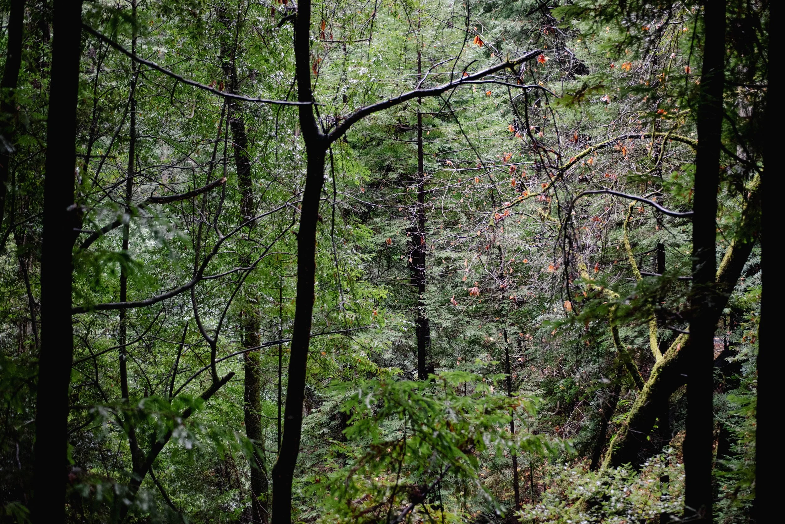
Mountain Quail habitat - photo by Peter Burnham
A note before we begin, in the same spirit as our chukar cornerstone. We are writing this as the pillar California Upland page on mountain quail, but we are not writing it as a record of our own California mountain quail seasons. Both of us have encountered mountain quail incidentally — Matt on the chaparral-to-conifer transitions of the Mendocino National Forest while hunting valley quail, Peter on the Sierra Nevada foothills above the Sacramento Valley quail country he's been working with Alan. Neither of us has hunted a dedicated mountain quail season in California. This is a planning-and-species cornerstone built from CDFW outlooks, USFS maps, four years of cross-referenced trip reports, and the body of work we've drafted on the species over the past quarter. When we publish our first dedicated mountain quail field report, the cornerstone gets a "lived: yes" pass and a real opening scene. Until then, this is the page for the hunter who is asking the same question we've been asking: how do you go mountain quail hunting in this state, honestly, the first time?
This is the pillar guide to Oreortyx pictus in California. We refresh it every July before the early opener. Every California Upland mountain quail piece will link back here.
Know the Bird
Mountain quail (Oreortyx pictus) is California's largest native quail — bigger than valley quail, bigger than Gambel's, sometimes described as approaching the size of a small partridge — and the only one of the state's three quail species that occupies cool, mid-elevation chaparral-and-conifer habitat rather than the warm-edge oak savanna and desert scrub of its congeners. The species runs from the northern Sierra and southern Cascades down through the Sierra Nevada, across the Coast Ranges, into the Los Padres, and south to the Peninsular Ranges of San Diego County. They are entirely a Pacific Coast bird — California, Oregon, southern Washington, the western edge of Nevada and Idaho — and California holds the largest range.
The bird is unmistakable when you see one. Adults run 7 to 9 ounces, larger than a valley quail. The plumage is striking — chestnut throat, slate-blue head and neck, bold white-on-chestnut barring on the flanks, an olive-and-chestnut back. The single straight, vertical black topknot (two narrow plumes pressed together so they read as one) is the species' diagnostic — not the forward-curving teardrop of the California valley quail or the slightly shorter teardrop of Gambel's. The legs are stronger than a valley quail's, and the bird runs as its primary escape behavior. Mountain quail will run uphill through chaparral for a quarter mile before flushing if the hunter doesn't intercept them. This running habit, combined with the bird's preference for the steepest and densest cover available, is the reason most California upland hunters never connect on mountain quail on purpose.
Coveys are smaller than valley quail coveys — typically 6 to 15 birds, sometimes up to 20 in a good year. The "quark-quark-quark" assembly call is louder and more carrying than the valley quail's "Chi-ca-go!" and is one of the great sounds of California chaparral; males call from elevated perches at dawn and dusk through the spring and early summer. A summer scouting drive in the right country at sunrise will surface a calling male if mountain quail are there.
The daily rhythm is similar to valley quail's but compressed by elevation and cover. First light: birds drop off roost (denser conifer or oak limbs three to seven feet up) and begin feeding along openings. Mid-morning: retreat into loafing cover — the thickest chaparral on the slope, often with a north-aspect bias for shade. Late afternoon: emerge again to feed. The hunting windows are first light and last ninety minutes, the same as valley quail.
The key difference from valley quail is the elevation cycle. Mountain quail are altitudinal migrants. They breed at high elevation (often 4,000 to 8,000 feet in the Sierra) and walk downhill through the fall and winter, sometimes covering 5,000 vertical feet of seasonal movement. By the October opener, birds are typically at 3,500 to 5,500 feet in the Sierra; by January they may be down to 2,000 to 3,500 feet. This means the country you scout in July is not always the country you hunt in November — the calendar moves the bird down the mountain, and the hunter has to move down with them.
Where They Live in California
Five practical mountain quail regions:
The Trinity Alps and Klamath Mountains. Trinity, Siskiyou, northern Humboldt, and Shasta counties. Mixed conifer-and-chaparral country in the Trinity Alps Wilderness, the Shasta-Trinity National Forest, and the Six Rivers National Forest. The northernmost and densest mountain quail populations in California; the country is remote, the access is mostly USFS, and the country produces some of the strongest covey densities in the species' range.
The Sierra Nevada — northern and central. Plumas, Lassen, Sierra, Nevada, Placer, El Dorado, Amador, Calaveras, Tuolumne, Mariposa, Madera, Fresno, Tulare, and Inyo counties (the west slope). Plumas, Lassen, Tahoe, Eldorado, Stanislaus, Sierra, and Sequoia national forests. The mountain quail belt runs along the chaparral-to-conifer transition at 3,500 to 6,500 feet through most of the year. This is the most accessible region — paved access on the major Sierra east-west routes (Highways 4, 88, 108, 120, 140, 178, 198, 245) — and the one most California hunters first encounter mountain quail in.
The southern Cascades. Tehama, Shasta, and Modoc counties. Lassen Volcanic NP edges, Lassen NF, the Pit River drainage. Mountain quail here overlap with the chukar at the higher elevations and with valley quail at the lower edges; pure mountain quail hunting concentrates in the chaparral-and-pine transitions at 3,500 to 5,500 feet.
The Inner Coast Range and the Los Padres. Mendocino, Lake, Napa, Sonoma (interior), Solano, Marin (northern), Glenn, Colusa counties to the north; the Mendocino National Forest in particular. To the south, Monterey, San Luis Obispo, Santa Barbara, Ventura counties — the Los Padres National Forest, the Ventana Wilderness, the higher portions of the Santa Lucia Range, and the elevation breaks of the Santa Ynez Mountains. Mountain quail densities are lower here than in the Sierra or Trinity Alps but the country is closer to the Bay Area and the SoCal population centers. Our planning piece on the Los Padres mountain-and-valley quail opportunity (in queue for June 30) goes deeper on the Los Padres setup.
The Peninsular Ranges of Southern California. San Bernardino, Riverside, San Diego counties. San Bernardino NF, Cleveland NF, San Jacinto Wilderness. Mountain quail are present and huntable at the elevation breaks (4,000 to 6,500 feet) but the country is small, the populations are thin, and the access is limited by extensive private holdings.
Within any of those regions, mountain quail are an elevation-and-cover bird. The country to look for is the chaparral-to-conifer transition — manzanita and ceanothus brush at the upper edge of where pure chaparral grows, transitioning into the lower edge of ponderosa-and-incense-cedar woodland. Add a water source within a quarter mile, add some open ground for feeding, and add the kind of vertical and broken terrain mountain quail prefer for cover. The species often follows logging roads and fuel breaks in the off-season — both as travel corridors and as edge habitat — which is one of the few places a hunter can predictably encounter them on foot.
Seasonal Patterns and the Annual Cycle
January–February. Coveys at their lowest elevation of the year — often at 2,500 to 4,000 feet in the Sierra. Birds concentrate on south-facing slopes for warmth, near remaining water.
March–April. Coveys begin breaking up. Pair formation. Males begin calling from elevated perches. Snow line retreats; birds begin walking uphill behind the snow melt.
May–June. Nesting at mid-elevation. Hens lay 9–14 eggs in a ground scrape under shrub cover. Peak calling — best month for off-season scouting by ear.
June–July. Hatch and brood movement. Broods follow the melting snow line uphill through the summer. By July most coveys are at their summer elevation maximum.
August. Broods consolidate. Coveys form. Best in-person scouting month.
September. Pre-opener. Some northern California zones open earlier than the statewide October date — verify each year.
Mid-September to October (depending on zone). Season opens (verify exact dates each year against current CDFW upland regulations; the mountain quail season has historically opened slightly earlier than the statewide upland opener in the higher-elevation northern California zones — sometimes as early as mid-September — to take advantage of the high-country season before snow). Coveys at maximum elevation; the high country is open, accessible, and birds are inexperienced.
November. Birds begin walking down the mountain ahead of weather. Coveys mix and re-form. Hunting opportunity shifts from the high country to the mid-elevation transitions.
December–January. Birds at mid-to-low elevation. Coveys concentrate on the limited remaining cover and water. Closing weeks are some of the best hunting of the season if the country is accessible (snow line permitting).
Late January. Season closes.
How We Hunt Them (Planning Version)
Same caveat as our chukar guide: we are writing this section from cross-referenced sources, not California field experience. When we have seasons in the can, this section gets rewritten.
1. Hunt the chaparral-conifer transition. Mountain quail occupy the cover between the two habitat types. Pure chaparral is too dense; pure conifer is too open. The 100-yard-wide edge between them, where the manzanita gives way to ponderosa and the slope eases into a small bench or saddle, is the country to walk. On a USGS topo, the edge is often visible as a vegetation-tone change running along contour at the upper elevation of the chaparral.
2. Walk the logging roads and fuel breaks at first light. This is the single most repeated piece of advice in every mountain quail resource we have read. Birds use linear features — roads, fuel breaks, ridge fingers — as travel corridors in the early morning. A hunter walking quietly along a closed Forest Service road at first light, glassing the cover edges every 200 yards, locates coveys before they relocate. Pointing dogs work along the edge; the hunter walks the road itself.
3. Expect the running flush. Mountain quail run before they fly. The first warning is often the sound of multiple birds moving through brush ahead of the dog — a faint patter, the leaves moving fifteen yards out — followed by a covey explosion uphill into chaparral where the shots are obscured. The countermove is to cut them off above. If you can get a hunter or a high-driving dog above the covey before the bird realizes it's pinned, the running escape route is closed and the flush goes downhill into open shooting. Mountain quail are the rare California upland bird where a two-hunter pincer makes a real difference.
4. Listen for the assembly call. The carrying "quark-quark-quark" male call is audible at half a mile on a still morning. A summer scouting drive — windows down, slow speed, stopping every quarter mile to listen — surfaces calling males. In October, after a covey flush, the same call from one of the scattered birds will pull the rest back together within 20 minutes. A hunter willing to sit on a stump and wait will get a second shot opportunity that a hunter who walks away from the flush will not.
5. Bring the right boots and the right pace. Mountain quail country is steeper than valley quail country and softer than chukar country — the underfoot conditions are decomposed granite, leaf litter, manzanita root mat, and the occasional snow patch in late season. The day is more about how many miles the legs and the dog can do at altitude than about how fast you cover any given mile. We will say more about pace in the gear section below.
Dogs
Mountain quail are a pointing-dog bird more than a flushing-dog bird, and the dog conversation tilts toward the breeds that handle altitude, distance, and rough cover: English pointers, English setters, GSPs, Brittanys (medium-range), French Brittanys. The country is too big for a close-working flushing dog to cover efficiently, and the running habit of the bird rewards a dog that can hold a long point on body language and birds-moving-on-the-ground scent. That said, a Labrador or a cocker that works close and respects scent can do well on roads-and-fuel-breaks setups where the country is more linear.
The conditioning question is real. Mountain quail country runs at 3,500 to 6,500 feet of elevation; a dog that lives at sea level needs time to acclimate, and even an acclimated dog covers less ground at altitude than at the home elevation. Peter has noted on Alan's Sierra foothill work (3,000 feet) that the cocker covers about 75% of the ground he would at Bay Area sea level. A real high-country mountain quail trip needs at least one acclimation day before the hunt and a slower pace through the first morning. Our heat-safety and conditioning piececovers the off-season physical prep; the altitude piece is the one we still want to write.
Gear
Shotgun. A 20-gauge or 12-gauge double or autoloader, improved cylinder to modified choke. Mountain quail shots typically run 15 to 30 yards but the cover is dense enough that "shoot the bird you see" is the rule. A 28-gauge is doable but loses meaningful pellet count if the bird gets into mid-range cover.
Shotshells. California has required nonlead shot for all hunting since 2019. For mountain quail, bismuth 6 or 7 in a 1-ounce 20-gauge or 1⅛-ounce 12-gauge is the workhorse. Steel 6s work but pattern tighter than ideal for the close-cover shots most mountain quail hunting produces. See our nonlead-ammo planning piece for the supply-cycle reasoning.
Pants and chaps. Brush pants are essential — chaparral and manzanita work on a dog and a hunter the same way they do in valley-quail country. Filson Shelter Cloth, Kuiu Attack, Tom Beckbe Tensaw. See our brush-pants gear guide.
Boots. A stiff-midsole, eight-to-ten-inch leather hunting boot with a real Vibram or comparable sole and a real toe rand. Crispi Wyoming, Russell Zephyr, Kenetrek Hardscrabble. The country eats cheap boots. The Crispi/Kenetrek/Russell tier earns the price.
Vest. A strap vest with good water capacity (the dog and the hunter both need more water at altitude than at the valley floor). Final Rise, Tom Beckbe, Filson Strap.
Maps and navigation. USGS topos, USFS motor vehicle use maps, OnX or Gaia. The country is bigger than it looks on the road map; a half-hour wrong turn can put you 1,500 feet below where you wanted to be. A GPS dog collar (Garmin Alpha or Pro 550) lets a wide-running pointer cover country the bell wouldn't tell you about.
Cold-weather layering. October at 5,500 feet can be 30°F at dawn and 70°F at noon. Weather pants, insulating mid-layer, wind shell, gloves. Pack light but pack for the range.
Regulations You Have to Know
Re-verify every year against the current CDFW upland regulations. What's here is the 2026-27 outlook; always confirm exact dates and limits in the CDFW upland game regulations booklet before opener.
License + Upland Game Bird Validation ($10 stamp). Funds California upland habitat work — see our upland-stamp piece.
Daily bag limit: 10 quail in any combination of California, mountain, and Gambel's. Possession limit 30.
Nonlead shot required statewide (AB 711). No exceptions.
HIP validation not required for quail.
Hunting hours: half hour before sunrise to sunset.
Season dates: the statewide upland opener is typically mid-October; the mountain quail-specific early opener in northern California zones has historically run from mid-September to early October — verify the early-zone dates each year because they shift and they are the difference between a high-country season and a snow-shortened mid-country season.
Conservation: Habitat, Climate, and the Long-Term Question
Mountain quail are the species most affected by long-term climate trends among California's quail. Two effects matter most:
Chaparral-to-conifer transition shifts. As fire return intervals shorten and the chaparral fuel load reorganizes, the chaparral-to-conifer ecotone moves uphill on average. The transition that produced mountain quail country at 4,500 feet in 1980 may produce it at 5,200 feet in 2030. The species adapts as long as the country has elevation to move into; in the southern parts of the range (the Peninsular Ranges, the Los Padres) there is less uphill room.
Post-fire recovery and the missing brush. Severe stand-replacing fires in mountain quail country produce 5–10 years of poor cover before the chaparral and the conifer regeneration restore the structure mountain quail need. The post-fire window is one of the biggest conservation questions in California upland — mountain quail populations in the 2017–2022 burn footprint of the northern Sierra are still recovering, and the trajectory depends on what burns next.
The third quiet conservation issue is forest road decommissioning. The USFS Travel Management Rule has closed thousands of miles of Forest Service roads to motor vehicle use over the last 15 years. The closures benefit big game and watersheds but they reduce the linear-feature hunting access that mountain quail hunters depend on. Hunters with an interest in retaining road-and-fuel-break access should engage with USFS forest plan revisions when they come up.
If you hunt mountain quail, the practical conservation moves are: buy the upland stamp every year, support Quail Forever's California chapters, show up for one Hands-On Habitat Month workday in May, and write public comments when USFS forest plan revisions touch the mountain quail belt.
How to Use This Guide
This is the cornerstone — the canonical link target. Every California Upland piece that touches mountain quail links back here, and we link out from here to the specific scouting, gear, dog, and conservation pieces that go deeper on each angle. We refresh this guide in full each July; the regulations, the burn-and-snow references, and the recent field-report citations get updated then.
If you came in through the search results, the next reads to make use of this:
The California Valley Quail Hunting Guide (the related-bird companion)
Nonlead Ammunition for California Upland Hunters: 2026-27 Supply Planning
Your Upland Stamp at Work: How California's $10 Validation Funds Wild Bird Habitat
If you want the weekly digest that puts new planning pieces and field reports in your inbox each Sunday, plus our 2026-27 California Upland Cheatsheet as a thank-you, the subscribe page is the place.
The country is high. The country is steep. The country is also some of the most beautiful upland hunting on the continent — the conifer-and-chaparral mosaic at 5,000 feet in late October, the elk-bugle distance of a calling male before sunrise, the long view down the slope from a vantage we'd never have visited if we weren't looking for a bird almost nobody hunts on purpose. We will write the field report when we have it. Until then, this is the page. Good hunting.
— Matt & Peter California Upland
Matt Gehrmann grew up hunting the Central Valley for pheasant, quail, and dove, and is based in the Bay Area. Read more → · Subscribe to the weekly digest →
Peter Burnham grew up in Nevada hunting chukar in the Sierras and dove in the valleys and hunts behind Alan (a three-year-old English cocker). Read more → · Subscribe to the weekly digest →