
California's Coastal Sage Scrub for Valley Quail: The South Coast Range from Monterey to Santa Barbara
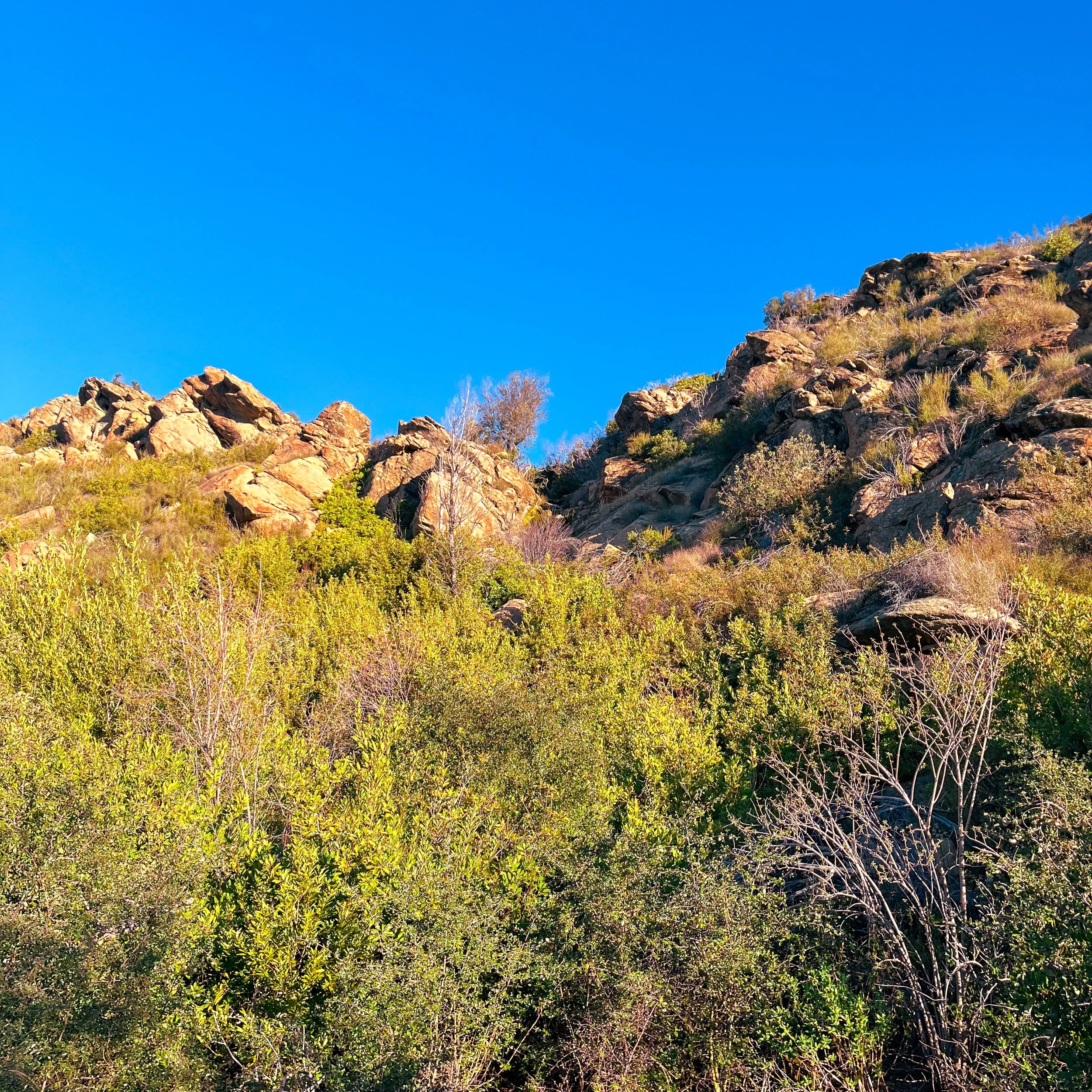
Brush hopefully holding quail - photo by Peter Burnham
Coastal sage scrub is the habitat most California upland hunters can't name. It's not chaparral. It's not oak woodland. It's not grassland. It's the soft-leaved, low, drought-deciduous shrub community that runs the Central and South Coast Ranges from roughly Monterey County south to the Mexican border — and it holds valley quail along almost the entire stretch.
I lived on the southern end of this country for several years and hunted enough of it to know the pattern is real. I haven't hunted the northern Monterey or San Luis Obispo portions, but I've scouted them. This piece is a habitat-first planning guide for the whole belt, written from partial lived experience and a winter of putting the ecological pieces together.
If you live in the South Coast Range and hunt this country regularly, hello@californiaupland.com. I want the published version of this to be sharper than what I can produce from where I sit.
What Coastal Sage Scrub Actually Is
Coastal sage scrub is a distinct California plant community — not the same as the chaparral that dominates the Inner Coast Range or the Sierra Nevada foothills. Three differences worth knowing as a hunter:
Plant height is lower. Coastal sage scrub averages 2-4 feet tall versus chaparral's 4-10 feet. The visibility through it is better. The walking is faster. The pants take less abuse.
Plants are drought-deciduous, not evergreen. California sagebrush (Artemisia californica), black sage (Salvia mellifera), white sage (S. apiana), purple sage (S. leucophylla), and the smaller shrubs drop or curl their leaves in late summer. By October the cover has thinned considerably — different than chaparral, which holds full canopy year-round.
It interfingers with grassland. Coastal sage scrub doesn't form continuous brush like chamise chaparral. It mosaics with native bunchgrass and non-native annual grasses in ways that produce the edge cover quail need.
Where coastal sage scrub grows, California quail thrive. The combination of low cover for hiding, open grass for foraging, and the mosaic structure is essentially the species' preferred habitat envelope.
The 250-Mile Belt
Coastal sage scrub runs in a band along California's coast from north of Monterey to the Mexican border. The huntable portion — public land accessible to hunters under California regulations — concentrates in five regions:
Monterey County coastal foothills. The country between the Salinas Valley floor and the Santa Lucia Range. BLM scattered parcels and the western edge of the Los Padres NF Monterey Ranger District. Lower bird density than farther south but accessible from the Bay Area.
San Luis Obispo County inland. The country from the Santa Margarita area east through the western Carrizo Plain edge. Mix of BLM, scattered USFS Los Padres, and some CDFW wildlife areas. The chamise-and-sage transitions here are some of the strongest coastal-sage quail country.
Santa Barbara County backcountry. The inland edge of the Los Padres NF Santa Barbara Ranger District. Significant condor recovery zone closures limit some access; the country that is open holds birds.
Ventura County to LA County foothills. Cleveland NF (Trabuco district), Angeles NF (San Gabriel foothills), and Santa Monica Mountains National Recreation Area (limited hunting, check rules carefully). Fragmented public access but real bird populations in the inland pieces.
San Diego County inland. Cleveland NF (Descanso, Palomar) and East County BLM. See the San Diego County valley quail piece for the deeper dive on this region.
The five regions share more than they differ. The same plant community, the same bird, the same hunting strategy — adjusted for the southward shift in climate and fire history.
How to Read Coastal Sage Scrub for Quail
Coastal sage scrub is not uniform across its range, and a hunter who learns to read the productive sub-types will out-hunt one who walks any patch of "sage."
Most productive: mosaic stage. Coastal sage with 30-60% native bunchgrass interspersed. Black sage and California sagebrush dominate the shrub layer; purple needlegrass, Stipa pulchra, or Nassella spp. dominate the grass. Quail use the shrubs for roost and escape; the grass for forage. The mosaic happens naturally on grazed BLM allotments where moderate stocking has prevented one species from dominating.
Productive: chamise-and-sage transitions. Where coastal sage scrub interfingers with chamise chaparral at higher elevations or south-facing hot slopes. The transitions concentrate quail because they offer both cover types within the same hundred-yard walk.
Less productive: pure coastal sage. Solid stands of black sage or California sagebrush without grass interspersion are too uniform. Quail use them as transit cover but don't congregate. Most pure stands are sign of fire history within the last 5-10 years; cover will rebuild over time.
Avoid: invasive-dominated. Coastal sage scrub heavily invaded by Mediterranean grasses (Bromus, Avena) or by stinkwort (Dittrichia graveolens) reads brown in spring and lacks the native seed production that quail need. These patches won't hold birds.
The single best indicator for a productive coastal-sage quail covey is spring greenup color on a satellite image. Productive sites show patchy green-and-tan mosaic from March through May; degraded sites show solid green (invasive grass) or solid brown (chamise without grass).
The 2026 Spring Rainfall Forecast
As of mid-June 2026, the 2026 spring rainfall on the Central Coast was [verify current numbers — Santa Maria, San Luis Obispo, Santa Barbara]. Coastal sage scrub responds to spring rain on a roughly 6-month lag, which means:
A wet spring produces strong fall covey numbers.
A dry spring produces thin coveys but the survivors concentrate around water and remain productively huntable.
A two-dry-springs-in-a-row scenario crashes the population for the following year.
The northern coastal sage country (Monterey/SLO) is more rain-dependent than the southern coastal sage country (Santa Barbara/Ventura/SD), which has slightly different rainfall patterns. The Santa Barbara County belt tends to be more consistent year-to-year because of the slightly warmer winter rains.
Public Access by Region
Critical reality: coastal sage scrub is mostly private land. The huntable public-land portion is fragmented — meaningful chunks in the Los Padres, scattered BLM, a few CDFW wildlife areas. A coastal-sage scouting trip is half-mapping-public-land before it becomes half-walking-it.
Where to start: the BLM California hunting opportunity locator, the USFS Los Padres National Forest district maps, and the CDFW wildlife area list for SLO, Santa Barbara, Ventura, and SD counties.
Where to avoid: any private inholding without explicit permission. Coastal sage country has a long history of private-land conservation easements (Tejon Ranch Conservancy, The Land Trust for Santa Barbara County, the Sempervirens Fund) — these protect habitat but do not grant hunting access. Verify before walking.
What I'm Bringing
The coastal sage kit is the lightest of any California upland habitat I run:
Brush pants but lighter. Kuiu Attack rather than Pro Brush — coastal sage cover is more forgiving than chamise chaparral.
Snake gaiters in early season. Pacific rattlers are active through October on south-facing slopes.
Tick prevention. Western blacklegged tick is endemic; permethrin-treated clothing.
More water than chamise hunting. Coastal sage country tends to be drier on average; fewer reliable springs.
Bismuth 7½ in the 20-gauge. Same load as the rest of California valley quail.
Conservation Frame
Coastal sage scrub is one of California's most-threatened plant communities. Development, fire, invasive grasses, and conversion have reduced the historical range by roughly 70% statewide. Where coastal sage persists on public land, the habitat is functioning at less than half its historical productivity in many areas.
Hunters benefit from coastal sage scrub conservation work even when it's done by non-hunting organizations. The Audubon California, the Tejon Ranch Conservancy, the Santa Barbara County Wildlife Conservation Foundation, and CDFW's Coast Quail Habitat Improvement Program have all funded coastal sage restoration projects. Every California upland stamp pays into some of this work.
The bird density we have on the South Coast Range today is the product of conservation decisions made in the 1990s and 2000s. The bird density we'll have in the 2030s depends on what gets funded now.
What I'll Report Back
Alan and I are aiming for a multi-day Central Coast trip — likely a Los Padres / Carrizo / Tejon edge loop — in late October or early November. The Field Report follows. If you've hunted coastal sage scrub regularly, the published version of this piece would be sharper with your input. hello@californiaupland.com.
Related reading:
Planning a Los Padres National Forest Upland Hunt (when published)
Carrizo Plain Valley Quail: A Public-Land Planning Guide (when published)
San Diego County Valley Quail: Cleveland NF and the Inland Foothills (when published)
How Spring Rainfall Shapes California Valley Quail Chick Survival
External: BLM California Hunting · USFS Los Padres National Forest · CDFW Upland Game Bird Hunting
Peter Burnham grew up in Nevada hunting chukar in the Sierras and dove in the valleys and hunts behind Alan (a three-year-old English cocker). Read more → · Subscribe to the weekly digest →
